I went to the site of the Battles of Saratoga. This was a turning point in the Revolution for the Americans. The battles occurred on September 19 and October 7, 1777 which resulted in the Americans halting the British's march south to Albany from Fort Ticonderoga.
Unfortunately I found out the hard way of how my phone saves panoramas so I lost most of my pictures so I don't have many left.
John Neilson House and Farm. The Neilson's family house and farm was seized by the Americans to fortify their position and used the farmhouse as a command center. It was used by Benedict Arnold. This house is the original one which stood in this spot in 1777.


British cannon given to the Americans after their loss

Location of American fortifications facing the Hudson River and road to Albany. This stronghold stopped the British from traveling south without fighting the Americans.

Blue stakes mark where the Americans had fortifications built


The main British location which they called the "great redoubt" where the majority of their force was located. The red stakes mark where the British had their fortifications built.


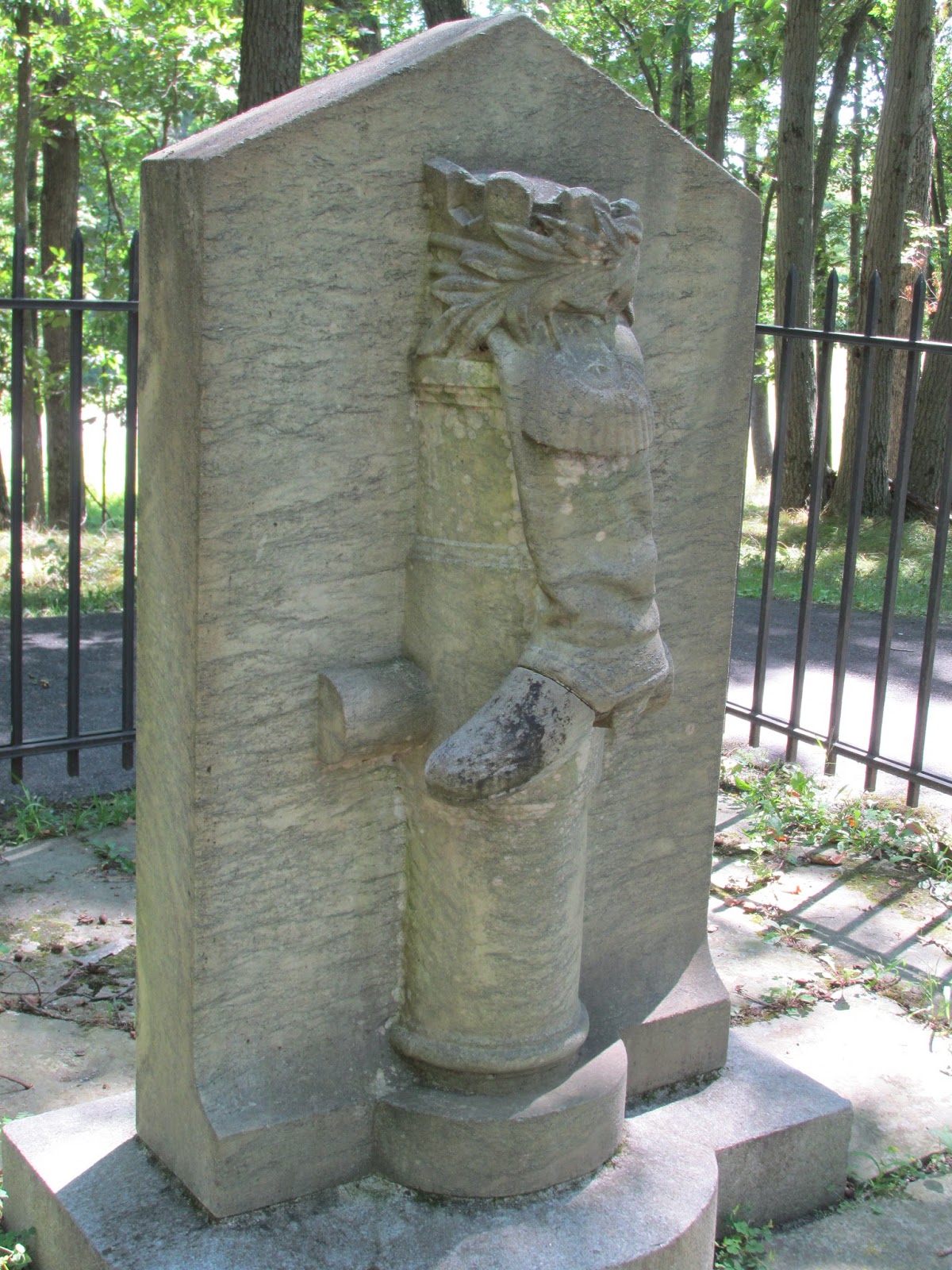
Monument to Benedict Arnold who led an attack after loosing his command by General Gates. He was shot in the foot leading an attack against the rear of a British fortification guarded by German Hessians. He was rewarded with the rank of Major General and because of him this fortification was taken. This fortification was located at the center of the British line which caused their almost immediate retreat and American victory.
These are the British river fortifications which protected their hospitals, supply lines, and retreat path.


